Ambae, the original Bali Hai
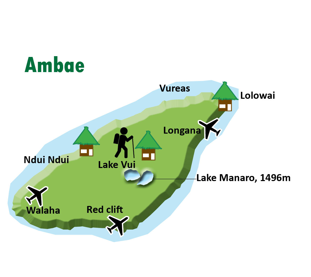 Ambae inspired James Michener's mysterious island of Bali Hai in his book Tales of the South Pacific. The island is a large active shield volcano, rising to 1496m above sea level. It's Vanuatu 's second highest island with crater lakes on the summit and cloud forests on the upper slopes. East Ambae is wet and the west is a rain-shadow area.
Ambae is physically characterized by the large volcano at its center, Manaro; indeed, the island is little more than the peak of a volcanic mountain rising dramatically from the sea. This volcano has no visible vents at its apex, only crater lakes —Manaro is widely regarded as one of the world's top ten 'most dangerous' volcanoes, in terms of potential for a catastrophic eruption. Ambae's west and northeast are densely populated. Elsewhere there are few villages. The centre for PENAMA province is at Saratamata in the northeast. Ambae is famous for its aelan taro and melo-melo kava. Ambae is an excellent place for hiking and walking, good for bird watching and there are secluded beaches in the south.
Ambae is an excellent place for hiking and walking, good for bird watching and there are secluded beaches in the south. Not many tourists visit Ambae even though it's close to Santo with frequent and inexpensive transport links.
There are weekly flights to Ambae and one or two ships per week between Luganville and Ambae. The crossing takes three to four hours but more than half a day can be spent servicing the villages around the island. Note these are cargo boats and not ferry boats —ships also pass by Ambae on their return from Port Vila to Santo and stop at most places on the northeast and west of the island. Good places to find ships are Ndui Ndui in the west and Lolopuepue and Lolowai in the north. Road transport —Ambae has extensive road networks in the west and northeast but the rugged coastline prevents a complete round-island road.